
Thank you for supporting this site ❤️
Make a donation
Make a donation
Gear up for your next adventure:
As an Amazon Associate, this site earns from qualifying purchases at no extra cost to you.
Ambohimalaza topographic map
Click on the map to display elevation.
Thank you for supporting this site ❤️
Make a donation
Make a donation
Gear up for your next adventure:
As an Amazon Associate, this site earns from qualifying purchases at no extra cost to you.
About this map
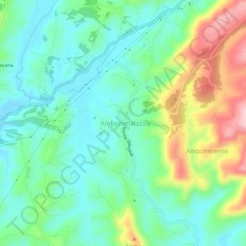
Name: Ambohimalaza topographic map, elevation, terrain.
Average elevation: 4,446 ft
Minimum elevation: 4,222 ft
Maximum elevation: 4,948 ft
Thank you for supporting this site ❤️
Make a donation
Make a donation
Gear up for your next adventure:
As an Amazon Associate, this site earns from qualifying purchases at no extra cost to you.
Other topographic maps
Click on a map to view its topography, its elevation and its terrain.
Ankadinandriana
Madagascar > Analamanga > District d'Antananarivo Avaradrano
Average elevation: 4,652 ft
Ambohidrabiby
Madagascar > Analamanga > District d'Antananarivo Avaradrano
Average elevation: 4,482 ft