
Thank you for supporting this site ❤️
Make a donation
Make a donation
Gear up for your next adventure:
As an Amazon Associate, this site earns from qualifying purchases at no extra cost to you.
Brede topographic map
Click on the map to display elevation.
Thank you for supporting this site ❤️
Make a donation
Make a donation
Gear up for your next adventure:
As an Amazon Associate, this site earns from qualifying purchases at no extra cost to you.
About this map
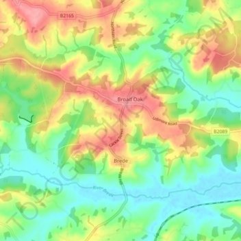
Name: Brede topographic map, elevation, terrain.
Location: Brede, Rother District, East Sussex, England, United Kingdom (50.92703 0.55277 50.96314 0.64143)
Average elevation: 131 ft
Minimum elevation: 0 ft
Maximum elevation: 315 ft
Thank you for supporting this site ❤️
Make a donation
Make a donation
Gear up for your next adventure:
As an Amazon Associate, this site earns from qualifying purchases at no extra cost to you.
Other topographic maps
Click on a map to view its topography, its elevation and its terrain.
Bewl Water
United Kingdom > England > East Sussex > Rother District > Ticehurst
Average elevation: 302 ft