
Thank you for supporting this site ❤️
Make a donation
Make a donation
Gear up for your next adventure:
As an Amazon Associate, this site earns from qualifying purchases at no extra cost to you.
Kibimba A topographic map
Click on the map to display elevation.
Thank you for supporting this site ❤️
Make a donation
Make a donation
Gear up for your next adventure:
As an Amazon Associate, this site earns from qualifying purchases at no extra cost to you.
About this map
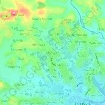
Name: Kibimba A topographic map, elevation, terrain.
Location: Kibimba A, Fort Portal City, Western Region, Uganda (0.65596 30.24625 0.69596 30.28625)
Average elevation: 5,046 ft
Minimum elevation: 4,898 ft
Maximum elevation: 5,420 ft
Thank you for supporting this site ❤️
Make a donation
Make a donation
Gear up for your next adventure:
As an Amazon Associate, this site earns from qualifying purchases at no extra cost to you.