
Make a donation
Gear up for your next adventure:
As an Amazon Associate, this site earns from qualifying purchases at no extra cost to you.
Santa Rosa topographic map
Click on the map to display elevation.
Make a donation
Gear up for your next adventure:
As an Amazon Associate, this site earns from qualifying purchases at no extra cost to you.
Santa Rosa
Santa Rosa ist eine Stadt und ein Municipio in der Provinz El Oro von Ecuador. Santa Rosa ist der Sitz des gleichnamigen Kantons. Teil des Municipios bildet die Parroquia urbana Santa Rosa. Sie ist die drittgrößte und bevölkerungsreichste Stadt in der Provinz El Oro. Sie liegt südlich der Küstenregion Ecuadors, in einer ausgedehnten Ebene am rechten Ufer des Flusses Santa Rosa auf einer Höhe von 10 Metern über dem Meeresspiegel und hat ein tropisches feuchtes Regenklima.
Make a donation
Gear up for your next adventure:
As an Amazon Associate, this site earns from qualifying purchases at no extra cost to you.
About this map
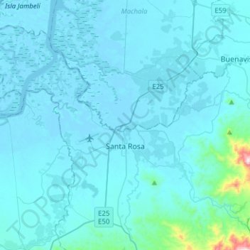
Name: Santa Rosa topographic map, elevation, terrain.
Location: Santa Rosa, El Oro, 070602, Ecuador (-3.50477 -80.06023 -3.35423 -79.80907)
Average elevation: 135 ft
Minimum elevation: -13 ft
Maximum elevation: 2,841 ft
Make a donation
Gear up for your next adventure:
As an Amazon Associate, this site earns from qualifying purchases at no extra cost to you.