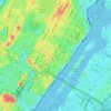
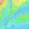
Bronx County topographic map
Click on the map to display elevation.
Bronx County
The Bronx's highest elevation at 280 feet (85 m) is in the northwest corner, west of Van Cortlandt Park and in the Chapel Farm area near the Riverdale Country School. The opposite (southeastern) side of the Bronx has four large low peninsulas or "necks" of low-lying land that jut into the waters of the East River and were once salt marsh: Hunt's Point, Clason's Point, Screvin's Neck and Throggs Neck. Further up the coastline, Rodman's Neck lies between Pelham Bay Park in the northeast and City Island. The Bronx's irregular shoreline extends for 75 square miles (194 km2).
About this map
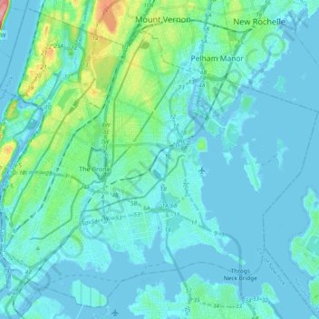
Name: Bronx County topographic map, elevation, terrain.
Location: Bronx County, New York, United States (40.78574 -73.93391 40.91763 -73.74837)
Average elevation: 69 ft
Minimum elevation: -30 ft
Maximum elevation: 456 ft
New York trails, hiking, mountain biking, running and outdoor activities
Other topographic maps
Click on a map to view its topography, its elevation and its terrain.

Snug Harbor Cultural Center and Botanical Garden
United States > New York > New York
Building C, also known as the Administration Building, was completed in 1833 and is Lafever's oldest surviving work. As of 2020, building C houses part of the Newhouse Center for Contemporary Art. The building consists of two stories, a raised basement, and an attic; it is rectangular in plan with a gable…
Average elevation: 66 ft

Flushing Meadows-Corona Park
United States > New York > New York
Around 1907, contractor Michael Degnon, whose firm constructed the Williamsburg Bridge, the Cape Cod Canal, and the Steinway subway tunnel (used by today's 7 and <7> trains), purchased large tracts of marsh near Flushing Creek. At the time, the land was considered "all but worthless". Degnon envisioned…
Average elevation: 49 ft
Snug Harbor Cultural Center and Botanical Garden
United States > New York > New York
Building C, also known as the Administration Building, was completed in 1833 and is Lafever's oldest surviving work. It houses part of the Newhouse Center for Contemporary Art. The building consists of two stories, a raised basement, and an attic; it is rectangular in plan with a gable roof. The main entrance…
Average elevation: 66 ft