
Thank you for supporting this site ❤️
Make a donation
Make a donation
Gear up for your next adventure:
As an Amazon Associate, this site earns from qualifying purchases at no extra cost to you.
Odwara topographic map
Click on the map to display elevation.
Thank you for supporting this site ❤️
Make a donation
Make a donation
Gear up for your next adventure:
As an Amazon Associate, this site earns from qualifying purchases at no extra cost to you.
About this map
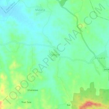
Name: Odwara topographic map, elevation, terrain.
Location: Odwara, Garhi Tehsil, Banswara, Rajasthan, 327034, India (23.49325 74.13686 23.53325 74.17686)
Average elevation: 607 ft
Minimum elevation: 518 ft
Maximum elevation: 823 ft
Thank you for supporting this site ❤️
Make a donation
Make a donation
Gear up for your next adventure:
As an Amazon Associate, this site earns from qualifying purchases at no extra cost to you.