Geolocate

Kcauri topographic map

Click on the map to display elevation.

About this map

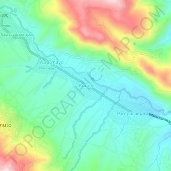
Name: Kcauri topographic map, elevation, terrain.

Location: Kcauri, Ccatca, Quispicanchi, Cusco, Perú (-13.65472 -71.54860 -13.61472 -71.50860)

Average elevation: 12,165 ft

Minimum elevation: 11,788 ft

Maximum elevation: 13,002 ft

Gear up for your next adventure:

📌Outdoor GPS Map App - Apps and devices for digital topographic navigation
📻Weather Alert Radios - Stay informed of storm risks while off-the-grid
👟Trail Running Shoes - Lightweight shoes for trail runners
🔦Powerful Headlamps - Ultra-bright hands-free lighting for night navigation
🧭Orienteering Set - Complete compass and map reading kit

As an Amazon Associate, this site earns from qualifying purchases at no extra cost to you.