
Make a donation
Gear up for your next adventure:
As an Amazon Associate, this site earns from qualifying purchases at no extra cost to you.
Marienborn topographic map
Click on the map to display elevation.
Make a donation
Gear up for your next adventure:
As an Amazon Associate, this site earns from qualifying purchases at no extra cost to you.
About this map
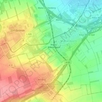
Name: Marienborn topographic map, elevation, terrain.
Location: Marienborn, Mainz, Rheinland-Pfalz, Deutschland (49.94763 8.20321 49.96849 8.24129)
Average elevation: 574 ft
Minimum elevation: 443 ft
Maximum elevation: 774 ft
Make a donation
Gear up for your next adventure:
As an Amazon Associate, this site earns from qualifying purchases at no extra cost to you.
Other topographic maps
Click on a map to view its topography, its elevation and its terrain.
Mainz
Deutschland > Rheinland-Pfalz > Mainz
Mainz befindet sich auf einer Höhe von 82 bis 245 m ü. NN. Die Stadt liegt am westlichen (linken) Ufer des Rheins, der die östliche Stadtgrenze bildet, mit Rheinkilometer 500 ungefähr auf halbem Wege zwischen Bodensee und Nordsee. Im Süden und Westen wird die Stadt im Mainzer Becken vom Rande der…
Average elevation: 600 ft
Make a donation
Gear up for your next adventure:
As an Amazon Associate, this site earns from qualifying purchases at no extra cost to you.