
Thank you for supporting this site ❤️
Make a donation
Make a donation
Gear up for your next adventure:
As an Amazon Associate, this site earns from qualifying purchases at no extra cost to you.
Sahel Chamali الساحل الشمالي topographic map
Click on the map to display elevation.
Thank you for supporting this site ❤️
Make a donation
Make a donation
Gear up for your next adventure:
As an Amazon Associate, this site earns from qualifying purchases at no extra cost to you.
About this map
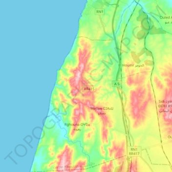
Name: Sahel Chamali الساحل الشمالي topographic map, elevation, terrain.
Average elevation: 207 ft
Minimum elevation: -3 ft
Maximum elevation: 722 ft
Thank you for supporting this site ❤️
Make a donation
Make a donation
Gear up for your next adventure:
As an Amazon Associate, this site earns from qualifying purchases at no extra cost to you.
Other topographic maps
Click on a map to view its topography, its elevation and its terrain.
Ouled El Mahdi
Morocco > cercle d'Assilah دائرة أصيلة > Aquouass Briech أقواس برييش
Average elevation: 66 ft