
Thank you for supporting this site ❤️
Make a donation
Make a donation
Gear up for your next adventure:
As an Amazon Associate, this site earns from qualifying purchases at no extra cost to you.
Silleda topographic map
Click on the map to display elevation.
Thank you for supporting this site ❤️
Make a donation
Make a donation
Gear up for your next adventure:
As an Amazon Associate, this site earns from qualifying purchases at no extra cost to you.
About this map
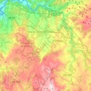
Name: Silleda topographic map, elevation, terrain.
Location: Silleda, O Deza, Pontevedra, Galicien, Spanien (42.59031 -8.37029 42.78435 -8.19683)
Average elevation: 1,647 ft
Minimum elevation: 203 ft
Maximum elevation: 3,310 ft
Thank you for supporting this site ❤️
Make a donation
Make a donation
Gear up for your next adventure:
As an Amazon Associate, this site earns from qualifying purchases at no extra cost to you.