Geolocate

Petersberg topographic map

Click on the map to display elevation.

About this map

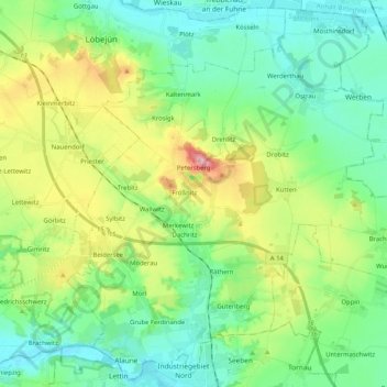
Name: Petersberg topographic map, elevation, terrain.

Location: Petersberg, Saalekreis, Saxony-Anhalt, 06193, Germany (51.52428 11.88254 51.64656 12.08764)

Average elevation: 400 ft

Minimum elevation: 233 ft

Maximum elevation: 801 ft

Gear up for your next adventure:

🥤Water Filter Bottle - All‑in‑one filter bottle for safe hydration
🎒Outdoor Daypacks - Lightweight backpacks designed for carrying maps and essential gear
🎒Gear Packing Cubes - Organize your backpack efficiently
🌡️Portable Weather Meter - Track weather conditions on the trail
🏔️Mountain Trail Maps - High‑detail maps for popular peaks

As an Amazon Associate, this site earns from qualifying purchases at no extra cost to you.