Geolocate

Hampton Trace topographic map

Click on the map to display elevation.

About this map

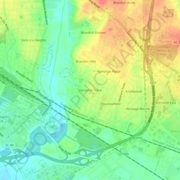
Name: Hampton Trace topographic map, elevation, terrain.

Location: Hampton Trace, Columbia, Richland County, South Carolina, 29209, United States (33.94543 -80.99009 33.98543 -80.95009)

Average elevation: 194 ft

Minimum elevation: 112 ft

Maximum elevation: 295 ft

Other topographic maps

Click on a map to view its topography, its elevation and its terrain.

Gear up for your next adventure:

🧴Hand Sanitizer - Keep hands clean while hiking
📦Gear Storage Bags - Organize and protect outdoor equipment
🛠️Outdoor Gear Repair Kit - Essential tools to fix gear on the trail
🛠️Backpacking Tool Kit - Essential toolkit for outdoor repairs
🥘Titanium Cookware - Durable, featherlight pots and pans for backpacking

As an Amazon Associate, this site earns from qualifying purchases at no extra cost to you.