
Make a donation
Gear up for your next adventure:
As an Amazon Associate, this site earns from qualifying purchases at no extra cost to you.
Owingsville topographic map
Click on the map to display elevation.
Make a donation
Gear up for your next adventure:
As an Amazon Associate, this site earns from qualifying purchases at no extra cost to you.
About this map
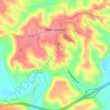
Name: Owingsville topographic map, elevation, terrain.
Location: Owingsville, Bath County, Kentucky, 40360, United States (38.12246 -83.77865 38.15295 -83.74223)
Average elevation: 860 ft
Minimum elevation: 679 ft
Maximum elevation: 1,017 ft
Bath County trails, hiking, mountain biking, running and outdoor activities
Make a donation
Gear up for your next adventure:
As an Amazon Associate, this site earns from qualifying purchases at no extra cost to you.
Other topographic maps
Click on a map to view its topography, its elevation and its terrain.
Pioneer Weapons Wildlife Management Area
United States > Kentucky > Bath County
Average elevation: 1,060 ft