
Thank you for supporting this site ❤️
Make a donation
Make a donation
Gear up for your next adventure:
As an Amazon Associate, this site earns from qualifying purchases at no extra cost to you.
Carpapata topographic map
Click on the map to display elevation.
Thank you for supporting this site ❤️
Make a donation
Make a donation
Gear up for your next adventure:
As an Amazon Associate, this site earns from qualifying purchases at no extra cost to you.
About this map
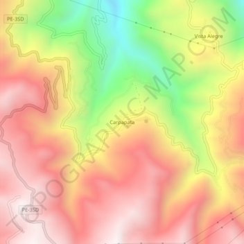
Name: Carpapata topographic map, elevation, terrain.
Location: Carpapata, Colcabamba, Tayacaja, Huancavelica, Perú (-12.41484 -74.77216 -12.37484 -74.73216)
Average elevation: 12,703 ft
Minimum elevation: 10,607 ft
Maximum elevation: 14,121 ft
Thank you for supporting this site ❤️
Make a donation
Make a donation
Gear up for your next adventure:
As an Amazon Associate, this site earns from qualifying purchases at no extra cost to you.