Geolocate

Wilderness topographic map

Click on the map to display elevation.

About this map

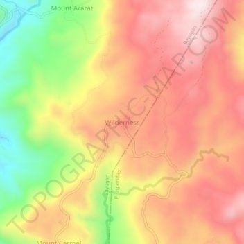
Name: Wilderness topographic map, elevation, terrain.

Location: Wilderness, Bayugan, Agusan del Sur, Caraga, Philippines (8.78691 125.81934 8.82691 125.85934)

Average elevation: 2,031 ft

Minimum elevation: 981 ft

Maximum elevation: 2,762 ft

Other topographic maps

Click on a map to view its topography, its elevation and its terrain.

Wawa Dam

Philippines > Agusan del Sur > Bayugan

Average elevation: 256 ft

Gear up for your next adventure:

🧭Outdoor Navigation Book - Learn advanced navigation skills
🧷Carabiner Set - Durable clips for gear attachment
🧥Waterproof Jacket for Hiking - Breathable and rugged rain jacket for outdoor excursions
🥤Water Filter Bottle - All‑in‑one filter bottle for safe hydration
🧭Hiking Compass - Precision compass for reliable navigation in the wilderness

As an Amazon Associate, this site earns from qualifying purchases at no extra cost to you.