Geolocate

Jequetepeque topographic map

Click on the map to display elevation.

About this map

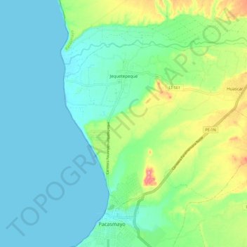
Name: Jequetepeque topographic map, elevation, terrain.

Location: Jequetepeque, Province of Pacasmayo, La Libertad, Peru (-7.39486 -79.58983 -7.32293 -79.48079)

Average elevation: 89 ft

Minimum elevation: -3 ft

Maximum elevation: 351 ft

Gear up for your next adventure:

🪶Fire Starter Kit - Reliable fire starter for survival and camping
😴Insulated Sleeping Pads - Compact and warm pads for high-elevation camping
GPS Sports Watch - GPS watch for running, hiking and training
🛰️Satellite Messengers - Emergency SOS and two-way messaging for off-grid adventures
🥩Freeze-Dried Meals - Nutritious and lightweight food for remote expeditions

As an Amazon Associate, this site earns from qualifying purchases at no extra cost to you.