
Thank you for supporting this site ❤️
Make a donation
Make a donation
Gear up for your next adventure:
As an Amazon Associate, this site earns from qualifying purchases at no extra cost to you.
Gondoriz topographic map
Click on the map to display elevation.
Thank you for supporting this site ❤️
Make a donation
Make a donation
Gear up for your next adventure:
As an Amazon Associate, this site earns from qualifying purchases at no extra cost to you.
About this map
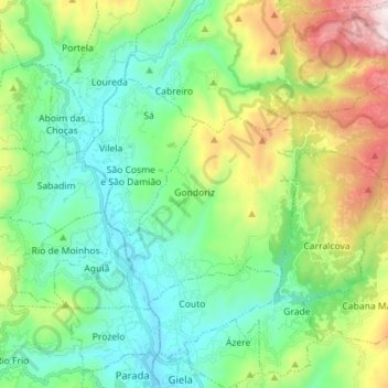
Name: Gondoriz topographic map, elevation, terrain.
Location: Gondoriz, Arcos de Valdevez, Viana do Castelo, Portugal (41.87330 -8.43363 41.93592 -8.29186)
Average elevation: 1,135 ft
Minimum elevation: 102 ft
Maximum elevation: 3,724 ft
Thank you for supporting this site ❤️
Make a donation
Make a donation
Gear up for your next adventure:
As an Amazon Associate, this site earns from qualifying purchases at no extra cost to you.