Geolocate

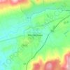
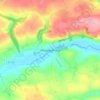
Watergrasshill topographic map

Click on the map to display elevation.

Watergrasshill

According to A Topographical Dictionary of Ireland, published by Samuel Lewis in 1837, Watergrasshill then had a population of 533 people.

Wikipedia (CC-BY-SA 3.0)

About this map

Name: Watergrasshill topographic map, elevation, terrain.

Location: Watergrasshill, Municipal District of Cobh, County Cork, Munster, Ireland (52.00589 -8.35216 52.01743 -8.32942)

Average elevation: 538 ft

Minimum elevation: 410 ft

Maximum elevation: 640 ft

Other topographic maps

Click on a map to view its topography, its elevation and its terrain.
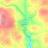
Lisgoold

Ireland > County Cork

Average elevation: 367 ft

Mitchelstown

Ireland > County Cork > Mitchelstown

Average elevation: 417 ft

Macroom

Ireland > County Cork > Blarney - Macroom > Macroom

Average elevation: 377 ft

Halfway

Ireland > County Cork

Average elevation: 315 ft

Model Village

Ireland > County Cork

Average elevation: 328 ft

Minane Bridge

Ireland > County Cork

Average elevation: 230 ft

Leamlara

Ireland > County Cork

Average elevation: 476 ft

Kilmichael

Ireland > County Cork

Average elevation: 436 ft

Gear up for your next adventure:

📱Solar Portable Charger - Solar power bank for charging devices off‑grid
📷Action Camera - Capture your outdoor adventures in HD
🔪Outdoor Multitools - Essential survival tools for gear repair and field use
🪶Compact Camp Shovel - Folding shovel for campsite tasks
🪓Survival Multi‑Tool - Versatile tool for camp and trail tasks

As an Amazon Associate, this site earns from qualifying purchases at no extra cost to you.