Geolocate

Gedong topographic map

Click on the map to display elevation.

About this map

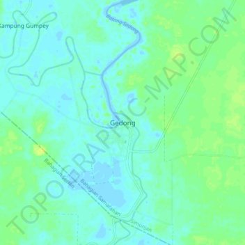
Name: Gedong topographic map, elevation, terrain.

Location: Gedong, Simunjan, Samarahan Division, Sarawak, Malaysia (1.20500 110.64980 1.28500 110.72980)

Average elevation: 16 ft

Minimum elevation: -10 ft

Maximum elevation: 46 ft

Other topographic maps

Click on a map to view its topography, its elevation and its terrain.

Taman Botani

Malaysia > Sarawak > Simunjan > Simunjan

Average elevation: 3 ft

Sungai Apin

Malaysia > Sarawak > Simunjan

Average elevation: 59 ft

Kampung Sual

Malaysia > Sarawak > Simunjan

Average elevation: 269 ft

Kampung Sungai Lingkau

Malaysia > Sarawak > Simunjan

Average elevation: 10 ft

Kampung Sageng

Malaysia > Sarawak > Simunjan

Average elevation: 3 ft

Gear up for your next adventure:

🧭Pro Hiking Compasses - High-accuracy liquid-filled compasses for topographic orientation
🎒Hydration Pack - Hands‑free water reservoir for long hikes
🔦Powerful Headlamps - Ultra-bright hands-free lighting for night navigation
🪵Folding Camp Saw - Compact saw for wood and campsite work
Camping Coffee Makers - Enjoy premium coffee at the summit or campsite

As an Amazon Associate, this site earns from qualifying purchases at no extra cost to you.