
Make a donation
Gear up for your next adventure:
As an Amazon Associate, this site earns from qualifying purchases at no extra cost to you.
Sanborn topographic map
Click on the map to display elevation.
Make a donation
Gear up for your next adventure:
As an Amazon Associate, this site earns from qualifying purchases at no extra cost to you.
About this map
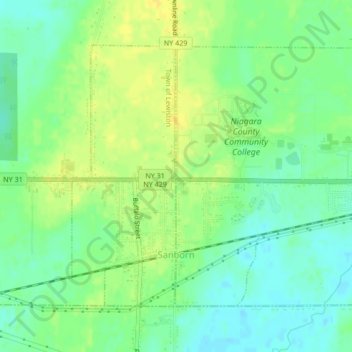
Name: Sanborn topographic map, elevation, terrain.
Average elevation: 633 ft
Minimum elevation: 597 ft
Maximum elevation: 669 ft
Niagara County trails, hiking, mountain biking, running and outdoor activities
Make a donation
Gear up for your next adventure:
As an Amazon Associate, this site earns from qualifying purchases at no extra cost to you.
Other topographic maps
Click on a map to view its topography, its elevation and its terrain.
Love Canal
United States > New York > Niagara County > City of Niagara Falls > Black Creek Village
Residents were suspicious of black fluid that flowed out of the Love Canal. For years, residents had complained about odors and substances in their yards or the public playgrounds. Finally, the city acted and hired a consultant, Calspan Corporation, to do a far-reaching study. In 1977, a harsh winter storm…
Average elevation: 577 ft
La Salle
United States > New York > Niagara County > Niagara Falls > La Salle
Average elevation: 577 ft
Lockport
United States > New York > Niagara County
Lockport is at the junction of several major truck routes, including NY Route 78 (Transit Road), NY Route 31, NY Route 77 and NY Route 93. It is 17 miles north of Interstate 90 via NY Route 78. The highest point is the bell tower at 452 High Street, with the street itself being the highest street as measured…
Average elevation: 499 ft
Escarpment
United States > New York > Niagara County > Town of Lewiston > Escarpment
Average elevation: 512 ft
Make a donation
Gear up for your next adventure:
As an Amazon Associate, this site earns from qualifying purchases at no extra cost to you.