Geolocate

Hartford topographic map

Click on the map to display elevation.

About this map

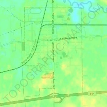
Name: Hartford topographic map, elevation, terrain.

Location: Hartford, Van Buren County, Michigan, 49057, United States (42.19165 -86.17657 42.21501 -86.15686)

Average elevation: 669 ft

Minimum elevation: 630 ft

Maximum elevation: 699 ft

Van Buren County trails, hiking, mountain biking, running and outdoor activities

Other topographic maps

Click on a map to view its topography, its elevation and its terrain.

Pine Grove

United States > Michigan > Van Buren County

Average elevation: 797 ft

Gear up for your next adventure:

🧣Merino Neck Gaiters - Multi-functional headwear for wind and sun protection
🛰️Satellite Messengers - Emergency SOS and two-way messaging for off-grid adventures
🎒Day Hiking Backpack - Lightweight backpack perfect for day trips and outdoor adventures
🥤Water Filter Bottle - All‑in‑one filter bottle for safe hydration
🔪Outdoor Multitools - Essential survival tools for gear repair and field use

As an Amazon Associate, this site earns from qualifying purchases at no extra cost to you.