Geolocate

Gulval topographic map

Click on the map to display elevation.

About this map

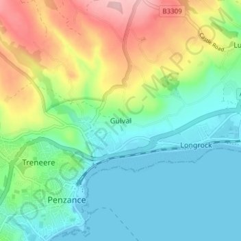
Name: Gulval topographic map, elevation, terrain.

Location: Gulval, Penzance, Cornwall, England, TR18 3BB, United Kingdom (50.11266 -5.54124 50.15266 -5.50124)

Average elevation: 174 ft

Minimum elevation: -3 ft

Maximum elevation: 541 ft

Gear up for your next adventure:

🎁Geography Themed Gifts - Unique gift ideas for map lovers and geography enthusiasts
📦Gear Storage Bags - Organize and protect outdoor equipment
🛶Inflatable Kayak - Portable kayak for rivers, lakes, and expeditions
📡GPS Antenna Upgrade - Enhance GPS reception in remote terrain
🌡️Portable Weather Meter - Track weather conditions on the trail

As an Amazon Associate, this site earns from qualifying purchases at no extra cost to you.