
Thank you for supporting this site ❤️
Make a donation
Make a donation
Gear up for your next adventure:
As an Amazon Associate, this site earns from qualifying purchases at no extra cost to you.
Najmah topographic map
Click on the map to display elevation.
Thank you for supporting this site ❤️
Make a donation
Make a donation
Gear up for your next adventure:
As an Amazon Associate, this site earns from qualifying purchases at no extra cost to you.
About this map
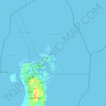
Name: Najmah topographic map, elevation, terrain.
Location: Najmah, Amwaj Islands, Muharraq Governorate, 110, Bahrain (25.97619 50.35049 26.61619 50.99049)
Average elevation: 3 ft
Minimum elevation: -7 ft
Maximum elevation: 404 ft
Thank you for supporting this site ❤️
Make a donation
Make a donation
Gear up for your next adventure:
As an Amazon Associate, this site earns from qualifying purchases at no extra cost to you.