Geolocate

Hilltown topographic map

Click on the map to display elevation.

About this map

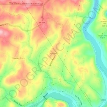
Name: Hilltown topographic map, elevation, terrain.

Location: Hilltown, Grayson County, Virginia, 24330, United States (36.71040 -81.00258 36.75040 -80.96258)

Average elevation: 2,385 ft

Minimum elevation: 2,073 ft

Maximum elevation: 2,690 ft

Grayson County trails, hiking, mountain biking, running and outdoor activities

Gear up for your next adventure:

🔥Camping Stove - Portable stove for camping and backcountry cooking
🚁Photography Drones - Capture stunning aerial views of landforms and topography
🧣Hiking Neck Gaiter - Multi‑use neck protection for outdoor weather
📦Gear Storage Bags - Organize and protect outdoor equipment
🦟Ultrasonic Repellers - Create a bug-free zone at your camp or rest stop

As an Amazon Associate, this site earns from qualifying purchases at no extra cost to you.