
Rehobeth topographic map
Click on the map to display elevation.
About this map
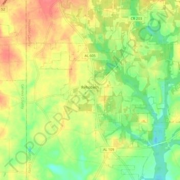
Name: Rehobeth topographic map, elevation, terrain.
Location: Rehobeth, Houston County, Alabama, United States (31.08429 -85.47846 31.15946 -85.41569)
Average elevation: 246 ft
Minimum elevation: 154 ft
Maximum elevation: 335 ft
Houston County trails, hiking, mountain biking, running and outdoor activities
Other topographic maps
Click on a map to view its topography, its elevation and its terrain.