
Thank you for supporting this site ❤️
Make a donation
Make a donation
Gear up for your next adventure:
As an Amazon Associate, this site earns from qualifying purchases at no extra cost to you.
Villamudria topographic map
Click on the map to display elevation.
Thank you for supporting this site ❤️
Make a donation
Make a donation
Gear up for your next adventure:
As an Amazon Associate, this site earns from qualifying purchases at no extra cost to you.
About this map
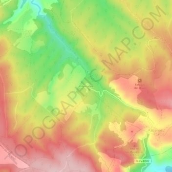
Name: Villamudria topographic map, elevation, terrain.
Location: Villamudria, Rábanos, Burgos, Castilla y León, 09269, España (42.31026 -3.31202 42.35026 -3.27202)
Average elevation: 3,783 ft
Minimum elevation: 3,337 ft
Maximum elevation: 4,114 ft
Thank you for supporting this site ❤️
Make a donation
Make a donation
Gear up for your next adventure:
As an Amazon Associate, this site earns from qualifying purchases at no extra cost to you.