
Thank you for supporting this site ❤️
Make a donation
Make a donation
Gear up for your next adventure:
As an Amazon Associate, this site earns from qualifying purchases at no extra cost to you.
Schönbachkopf topographic map
Click on the map to display elevation.
Thank you for supporting this site ❤️
Make a donation
Make a donation
Gear up for your next adventure:
As an Amazon Associate, this site earns from qualifying purchases at no extra cost to you.
About this map
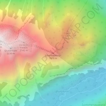
Name: Schönbachkopf topographic map, elevation, terrain.
Location: Schönbachkopf, Kuchl, Bezirk Hallein, Salzburg, 5431, Austria (47.58391 13.12067 47.58401 13.12077)
Average elevation: 4,137 ft
Minimum elevation: 1,575 ft
Maximum elevation: 7,464 ft
Thank you for supporting this site ❤️
Make a donation
Make a donation
Gear up for your next adventure:
As an Amazon Associate, this site earns from qualifying purchases at no extra cost to you.