
大湾乡 topographic map
Interactive map
Click on the map to display elevation.
About this map
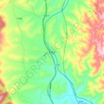
Name: 大湾乡 topographic map, elevation, terrain.
Location: 大湾乡, 泾源县, 固原市, 宁夏回族自治区, 中国 (35.69161 106.22928 35.77161 106.30928)
Average elevation: 6,798 ft
Minimum elevation: 6,033 ft
Maximum elevation: 8,045 ft
Other topographic maps
Click on a map to view its topography, its elevation and its terrain.