
Ackerly topographic map
Click on the map to display elevation.
About this map
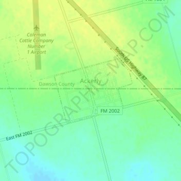
Name: Ackerly topographic map, elevation, terrain.
Location: Ackerly, Dawson County, Texas, United States (32.52004 -101.72228 32.52981 -101.70843)
Average elevation: 2,802 ft
Minimum elevation: 2,769 ft
Maximum elevation: 2,831 ft
Dawson County trails, hiking, mountain biking, running and outdoor activities
Other topographic maps
Click on a map to view its topography, its elevation and its terrain.