Geolocate

Ballplay topographic map

Click on the map to display elevation.

About this map

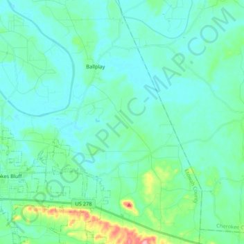
Name: Ballplay topographic map, elevation, terrain.

Location: Ballplay, Etowah County, Alabama, United States (33.96100 -85.84109 34.09531 -85.73714)

Average elevation: 584 ft

Minimum elevation: 505 ft

Maximum elevation: 994 ft

Etowah County trails, hiking, mountain biking, running and outdoor activities

Gear up for your next adventure:

🔦Compact Flashlight - Reliable flashlight for emergencies
🕶️GPS Smartphone Mount - Secure mount for phone navigation
🌎3D Topographic Globes - Raised relief globes for a tactile understanding of geography
🔥Camping Stove - Portable stove for camping and backcountry cooking
📱Solar Portable Charger - Solar power bank for charging devices off‑grid

As an Amazon Associate, this site earns from qualifying purchases at no extra cost to you.