Geolocate

Velguem topographic map

Click on the map to display elevation.

About this map

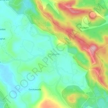
Name: Velguem topographic map, elevation, terrain.

Location: Velguem, Bicholim, North Goa District, Goa, India (15.48189 74.03292 15.52189 74.07292)

Average elevation: 249 ft

Minimum elevation: 33 ft

Maximum elevation: 663 ft

Other topographic maps

Click on a map to view its topography, its elevation and its terrain.

Cudnem River

India > Goa > Bicholim > Amona

Average elevation: 59 ft

Gear up for your next adventure:

🎒Waterproof Dry Bags - Keep your electronics and maps dry inside your pack
🛌Ultralight Sleeping Bags - Compact down bags for cold nights in the wilderness
🛶Inflatable Kayak - Portable kayak for rivers, lakes, and expeditions
🔌USB Car Charger - Car charger for on‑the‑go power needs
GPS Sports Watch - GPS watch for running, hiking and training

As an Amazon Associate, this site earns from qualifying purchases at no extra cost to you.