
Thank you for supporting this site ❤️
Make a donation
Make a donation
Gear up for your next adventure:
As an Amazon Associate, this site earns from qualifying purchases at no extra cost to you.
Peneda topographic map
Click on the map to display elevation.
Thank you for supporting this site ❤️
Make a donation
Make a donation
Gear up for your next adventure:
As an Amazon Associate, this site earns from qualifying purchases at no extra cost to you.
About this map
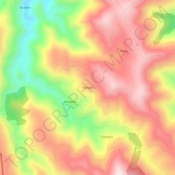
Name: Peneda topographic map, elevation, terrain.
Location: Peneda, San Antolín de Ibias, Ibias, Asturies, 33810, Espagne (43.02762 -6.93943 43.06762 -6.89943)
Average elevation: 2,136 ft
Minimum elevation: 935 ft
Maximum elevation: 3,012 ft
Thank you for supporting this site ❤️
Make a donation
Make a donation
Gear up for your next adventure:
As an Amazon Associate, this site earns from qualifying purchases at no extra cost to you.