
Thank you for supporting this site ❤️
Make a donation
Make a donation
Gear up for your next adventure:
As an Amazon Associate, this site earns from qualifying purchases at no extra cost to you.
Botro topographic map
Click on the map to display elevation.
Thank you for supporting this site ❤️
Make a donation
Make a donation
Gear up for your next adventure:
As an Amazon Associate, this site earns from qualifying purchases at no extra cost to you.
About this map
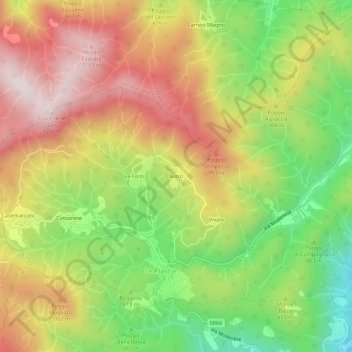
Name: Botro topographic map, elevation, terrain.
Location: Botro, Le Piastre, Pistoia, Toscana, 51028, Italia (43.99575 10.81773 44.03575 10.85773)
Average elevation: 2,844 ft
Minimum elevation: 1,736 ft
Maximum elevation: 3,940 ft
Thank you for supporting this site ❤️
Make a donation
Make a donation
Gear up for your next adventure:
As an Amazon Associate, this site earns from qualifying purchases at no extra cost to you.