Geolocate

Erbach topographic map

Click on the map to display elevation.

About this map

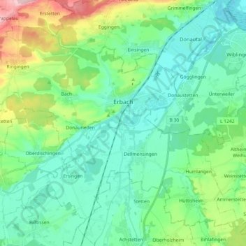
Name: Erbach topographic map, elevation, terrain.

Location: Erbach, Alb-Donau-Kreis, Baden-Württemberg, 89155, Germany (48.27019 9.76101 48.36412 9.94032)

Average elevation: 1,693 ft

Minimum elevation: 1,526 ft

Maximum elevation: 2,231 ft

Gear up for your next adventure:

❄️Traction Cleats - Prevent slips on icy trails during winter hikes
😴Insulated Sleeping Pads - Compact and warm pads for high-elevation camping
🎒Trekking Poles - Sturdy poles for balance and stability on rough terrain
🪓Survival Multi‑Tool - Versatile tool for camp and trail tasks
🛡️Bear Spray Outdoor - Protection in bear country hikes

As an Amazon Associate, this site earns from qualifying purchases at no extra cost to you.