Geolocate

Chenango Bridge topographic map

Click on the map to display elevation.

Chenango Bridge

Chenango Bridge is located at 42°10′00″N 075°51′45″W / 42.16667°N 75.86250°W / 42.16667; -75.86250 (42.1667426, -75.8624167) and its elevation is 896 feet (273 m).

Wikipedia (CC-BY-SA 3.0)

About this map

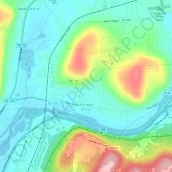
Name: Chenango Bridge topographic map, elevation, terrain.

Location: Chenango Bridge, Town of Chenango, Broome County, New York, 13745, United States (42.16068 -75.88543 42.18285 -75.82961)

Average elevation: 1,017 ft

Minimum elevation: 827 ft

Maximum elevation: 1,480 ft

Broome County trails, hiking, mountain biking, running and outdoor activities

Gear up for your next adventure:

🔥Fast-Boil Camping Stoves - Efficient cooking systems for quick trail meals
🥾Men's Hiking Boots - Durable, waterproof footwear for rugged terrain and steep inclines
🪶Trail Camera - Capture wildlife on your hikes
🧭GPS Watch Accessories - Bands and chargers for GPS watches
❄️Traction Cleats - Prevent slips on icy trails during winter hikes

As an Amazon Associate, this site earns from qualifying purchases at no extra cost to you.