
来凤县 topographic map
Interactive map
Click on the map to display elevation.
About this map
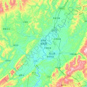
Name: 来凤县 topographic map, elevation, terrain.
Location: 来凤县, 恩施土家族苗族自治州, 湖北省, 中国 (29.33576 109.24327 29.65576 109.56327)
Average elevation: 2,198 ft
Minimum elevation: 1,371 ft
Maximum elevation: 4,649 ft
Other topographic maps
Click on a map to view its topography, its elevation and its terrain.