Geolocate

Digha topographic map

Click on the map to display elevation.

Digha

Digha is located at 21°38′18″N 87°30′35″E / 21.6384°N 87.5096°E / 21.6384; 87.5096. It has an average elevation of 6 metres (20 ft).

About this map

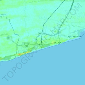
Name: Digha topographic map, elevation, terrain.

Location: Digha, Ramnagar-I, Purba Medinipur, West Bengal, 721428, India (21.58433 87.46952 21.66433 87.54952)

Average elevation: 13 ft

Minimum elevation: -3 ft

Maximum elevation: 98 ft

Gear up for your next adventure:

📷Action Camera - Capture your outdoor adventures in HD
📱Solar Portable Charger - Solar power bank for charging devices off‑grid
🥾Hiking Shoes - Durable and comfortable shoes for trail hiking
🌄Hiking Binoculars - Compact binoculars for scenic views and trail spotting
🥤Water Filter Bottle - All‑in‑one filter bottle for safe hydration

As an Amazon Associate, this site earns from qualifying purchases at no extra cost to you.