Geolocate

Lac Chancy topographic map

Click on the map to display elevation.

About this map

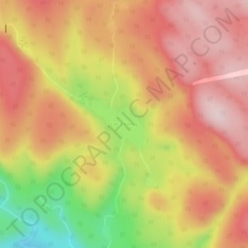
Name: Lac Chancy topographic map, elevation, terrain.

Location: Lac Chancy, Trois-Rives, Mékinac, Mauricie, Québec, Canada (46.88508 -72.86774 46.89030 -72.85792)

Average elevation: 961 ft

Minimum elevation: 348 ft

Maximum elevation: 1,339 ft

Other topographic maps

Click on a map to view its topography, its elevation and its terrain.

Rivière-Matawin

Canada > Québec > Mékinac > Trois-Rives

Average elevation: 659 ft

Lac Mékinac

Canada > Québec > Mékinac > Trois-Rives

Une presqu'île située au milieu du lac Mékinac, sur la rive Est (dans la municipalité de Trois-Rives), est désignée le Trou-du-Steamboa, à la sortie du bras Groleau dont le sommet de la montagne voisine (côté nord) atteint plus de 320 mètres d'altitude. Dans ce secteur, les montagnes des deux côtés…

Average elevation: 942 ft

Lac du Missionnaire

Canada > Québec > Mékinac > Trois-Rives

Average elevation: 958 ft

Saint-Joseph-de-Mékinac

Canada > Québec > Mékinac > Trois-Rives

Average elevation: 538 ft

Lac Dawson

Canada > Québec > Mékinac > Trois-Rives

Average elevation: 1,106 ft

Gear up for your next adventure:

🦶Hiking Gaiters - Keep debris and water out of your boots
🪶Multi‑Purpose Knife - Useful blade for camp and trail
🕶️GPS Smartphone Mount - Secure mount for phone navigation
🥾Women's Hiking Boots - Top-rated trail boots with ankle support and superior grip
🪶Trail Camera - Capture wildlife on your hikes

As an Amazon Associate, this site earns from qualifying purchases at no extra cost to you.