Geolocate

Masara topographic map

Click on the map to display elevation.

About this map
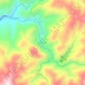
Name: Masara topographic map, elevation, terrain.

Location: Masara, Maco, Davao de Oro, Davao Region, 8806, Philippines (7.36927 126.01023 7.40927 126.05023)

Average elevation: 2,326 ft

Minimum elevation: 1,102 ft

Maximum elevation: 3,602 ft

Gear up for your next adventure:

🧤Hiking Gloves - Protective gloves for rugged trails
🥾Women's Hiking Boots - Top-rated trail boots with ankle support and superior grip
🪑Ultralight Camp Chairs - Portable seating for resting after a long day of mapping
🛰️Handheld GPS Units - Professional satellite navigators for precise backcountry mapping
⛑️Personal Locator Beacon - Safety beacon for emergencies

As an Amazon Associate, this site earns from qualifying purchases at no extra cost to you.