
Thank you for supporting this site ❤️
Make a donation
Make a donation
Gear up for your next adventure:
As an Amazon Associate, this site earns from qualifying purchases at no extra cost to you.
Undangaon topographic map
Click on the map to display elevation.
Thank you for supporting this site ❤️
Make a donation
Make a donation
Gear up for your next adventure:
As an Amazon Associate, this site earns from qualifying purchases at no extra cost to you.
About this map
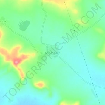
Name: Undangaon topographic map, elevation, terrain.
Location: Undangaon, Sillod, Aurangabad, Maharashtra, India (20.43562 75.64271 20.47562 75.68271)
Average elevation: 2,287 ft
Minimum elevation: 2,182 ft
Maximum elevation: 2,543 ft
Thank you for supporting this site ❤️
Make a donation
Make a donation
Gear up for your next adventure:
As an Amazon Associate, this site earns from qualifying purchases at no extra cost to you.