
Make a donation
Gear up for your next adventure:
As an Amazon Associate, this site earns from qualifying purchases at no extra cost to you.
Serreta topographic map
Click on the map to display elevation.
Make a donation
Gear up for your next adventure:
As an Amazon Associate, this site earns from qualifying purchases at no extra cost to you.
About this map
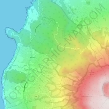
Name: Serreta topographic map, elevation, terrain.
Location: Serreta, Angra do Heroísmo, Azores, 9700-661, Portugal (38.73418 -27.37945 38.77890 -27.32388)
Average elevation: 1,227 ft
Minimum elevation: -13 ft
Maximum elevation: 3,287 ft
Make a donation
Gear up for your next adventure:
As an Amazon Associate, this site earns from qualifying purchases at no extra cost to you.
Other topographic maps
Click on a map to view its topography, its elevation and its terrain.
Make a donation
Gear up for your next adventure:
As an Amazon Associate, this site earns from qualifying purchases at no extra cost to you.
Túnel de Descarga da Barragem de Odeleite
Portugal > Faro > Castro Marim > Odeleite
Average elevation: 236 ft
Make a donation
Gear up for your next adventure:
As an Amazon Associate, this site earns from qualifying purchases at no extra cost to you.
Barão de São João
Portugal > Faro > Bensafrim e Barão de São João > Barão de São João
Average elevation: 289 ft
Monte Ruivo
Portugal > Beja > Odemira > Boavista dos Pinheiros > Monte Ruivo
Average elevation: 213 ft
Make a donation
Gear up for your next adventure:
As an Amazon Associate, this site earns from qualifying purchases at no extra cost to you.
Make a donation
Gear up for your next adventure:
As an Amazon Associate, this site earns from qualifying purchases at no extra cost to you.