
Thank you for supporting this site ❤️
Make a donation
Make a donation
Gear up for your next adventure:
As an Amazon Associate, this site earns from qualifying purchases at no extra cost to you.
Tocllaraju topographic map
Click on the map to display elevation.
Thank you for supporting this site ❤️
Make a donation
Make a donation
Gear up for your next adventure:
As an Amazon Associate, this site earns from qualifying purchases at no extra cost to you.
About this map
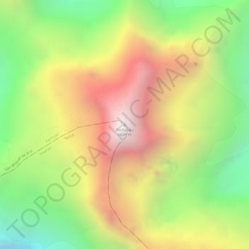
Name: Tocllaraju topographic map, elevation, terrain.
Location: Tocllaraju, Tarica, Huaraz, Áncash, Perú (-9.34713 -77.39714 -9.34703 -77.39704)
Average elevation: 17,451 ft
Minimum elevation: 15,289 ft
Maximum elevation: 19,534 ft
Thank you for supporting this site ❤️
Make a donation
Make a donation
Gear up for your next adventure:
As an Amazon Associate, this site earns from qualifying purchases at no extra cost to you.