
Thank you for supporting this site ❤️
Make a donation
Make a donation
Gear up for your next adventure:
As an Amazon Associate, this site earns from qualifying purchases at no extra cost to you.
飞来寺 topographic map
Click on the map to display elevation.
Thank you for supporting this site ❤️
Make a donation
Make a donation
Gear up for your next adventure:
As an Amazon Associate, this site earns from qualifying purchases at no extra cost to you.
About this map
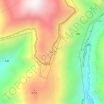
Name: 飞来寺 topographic map, elevation, terrain.
Location: 飞来寺, 升平镇, 德钦县, 迪庆藏族自治州, 云南省, 中国 (28.42630 98.86026 28.46630 98.90026)
Average elevation: 10,604 ft
Minimum elevation: 8,373 ft
Maximum elevation: 13,012 ft
Thank you for supporting this site ❤️
Make a donation
Make a donation
Gear up for your next adventure:
As an Amazon Associate, this site earns from qualifying purchases at no extra cost to you.