

Ellis Island topographic map
Click on the map to display elevation.
Ellis Island
The first floor contained detention rooms, social service offices, and waiting rooms on its west wing, a use that remained relatively unchanged. The central space was initially a baggage room until 1907, but was subsequently subdivided and later re-combined into a single records room. The first floor's east wing also contained a railroad waiting room and medical offices, though much of the wing was later converted to record rooms. A railroad ticket office annex was added to the north side of the first floor in 1905–1906. The south elevation of the first floor contains the current immigration museum's main entrance, approached by a slightly sloped passageway covered by a glass canopy. Though the canopy was added in the 1980s, it evokes the design of an earlier glass canopy on the site that existed from 1902 to 1932.
About this map
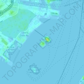
Name: Ellis Island topographic map, elevation, terrain.
Average elevation: 3 ft
Minimum elevation: -10 ft
Maximum elevation: 56 ft
Hudson County trails, hiking, mountain biking, running and outdoor activities
Other topographic maps
Click on a map to view its topography, its elevation and its terrain.
West Bergen
United States > New Jersey > Hudson County > Jersey City > Communipaw
Average elevation: 33 ft