
Thank you for supporting this site ❤️
Make a donation
Make a donation
Gear up for your next adventure:
As an Amazon Associate, this site earns from qualifying purchases at no extra cost to you.
Chopta topographic map
Click on the map to display elevation.
Thank you for supporting this site ❤️
Make a donation
Make a donation
Gear up for your next adventure:
As an Amazon Associate, this site earns from qualifying purchases at no extra cost to you.
About this map
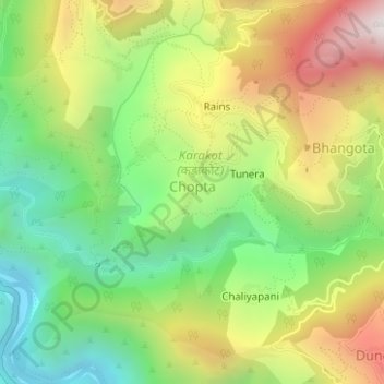
Name: Chopta topographic map, elevation, terrain.
Location: Chopta, Tharali, Chamoli district, Uttarakhand, India (30.17722 79.36464 30.18223 79.36965)
Average elevation: 4,682 ft
Minimum elevation: 3,068 ft
Maximum elevation: 6,844 ft
Thank you for supporting this site ❤️
Make a donation
Make a donation
Gear up for your next adventure:
As an Amazon Associate, this site earns from qualifying purchases at no extra cost to you.