
Thank you for supporting this site ❤️
Make a donation
Make a donation
Gear up for your next adventure:
As an Amazon Associate, this site earns from qualifying purchases at no extra cost to you.
Schlagturn topographic map
Click on the map to display elevation.
Thank you for supporting this site ❤️
Make a donation
Make a donation
Gear up for your next adventure:
As an Amazon Associate, this site earns from qualifying purchases at no extra cost to you.
About this map
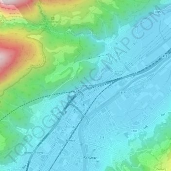
Name: Schlagturn topographic map, elevation, terrain.
Location: Schlagturn, Stans, Bezirk Schwaz, Tirol, 6135, Österreich (47.34190 11.68684 47.38190 11.72684)
Average elevation: 2,306 ft
Minimum elevation: 1,722 ft
Maximum elevation: 4,790 ft
Thank you for supporting this site ❤️
Make a donation
Make a donation
Gear up for your next adventure:
As an Amazon Associate, this site earns from qualifying purchases at no extra cost to you.