
Thank you for supporting this site ❤️
Make a donation
Make a donation
Gear up for your next adventure:
As an Amazon Associate, this site earns from qualifying purchases at no extra cost to you.
Stauda topographic map
Click on the map to display elevation.
Thank you for supporting this site ❤️
Make a donation
Make a donation
Gear up for your next adventure:
As an Amazon Associate, this site earns from qualifying purchases at no extra cost to you.
About this map
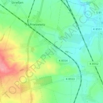
Name: Stauda topographic map, elevation, terrain.
Location: Stauda, Priestewitz, Meißen, Sachsen, 01558, Deutschland (51.22305 13.49807 51.26305 13.53807)
Average elevation: 499 ft
Minimum elevation: 400 ft
Maximum elevation: 709 ft
Thank you for supporting this site ❤️
Make a donation
Make a donation
Gear up for your next adventure:
As an Amazon Associate, this site earns from qualifying purchases at no extra cost to you.