Geolocate

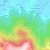
A Granda topographic map

Click on the map to display elevation.

About this map

Name: A Granda topographic map, elevation, terrain.

Location: A Granda, San Pedro de Mor, Alfoz, Mariña Central, Lugo, Galicia, 27773, España (43.51527 -7.43437 43.55527 -7.39437)

Average elevation: 233 ft

Minimum elevation: 121 ft

Maximum elevation: 722 ft

Other topographic maps

Click on a map to view its topography, its elevation and its terrain.
Monte de San Pedro

España > Galicia > Mariña Central > Alfoz > Presa Boa

Average elevation: 725 ft

Gear up for your next adventure:

📱Heavy-Duty Phone Cases - Drop-proof and waterproof protection for outdoor navigation
🪶Paracord Bracelet - Survival bracelet with built‑in tools
🔥Plasma Lighters - Windproof lighters that work in any weather condition
🪶LED Camping Lantern - Bright lantern for camp lighting
🌐World Map Poster - Decorative world maps with topographic info

As an Amazon Associate, this site earns from qualifying purchases at no extra cost to you.