
Thank you for supporting this site ❤️
Make a donation
Make a donation
Gear up for your next adventure:
As an Amazon Associate, this site earns from qualifying purchases at no extra cost to you.
Merilla topographic map
Click on the map to display elevation.
Thank you for supporting this site ❤️
Make a donation
Make a donation
Gear up for your next adventure:
As an Amazon Associate, this site earns from qualifying purchases at no extra cost to you.
About this map
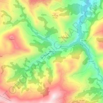
Name: Merilla topographic map, elevation, terrain.
Location: Merilla, San Roque de Riomiera, Cantabria, 39728, Spain (43.23274 -3.75034 43.27274 -3.71034)
Average elevation: 1,762 ft
Minimum elevation: 771 ft
Maximum elevation: 2,851 ft
Thank you for supporting this site ❤️
Make a donation
Make a donation
Gear up for your next adventure:
As an Amazon Associate, this site earns from qualifying purchases at no extra cost to you.