
Mheer topographic map
Interactive map
Click on the map to display elevation.
About this map
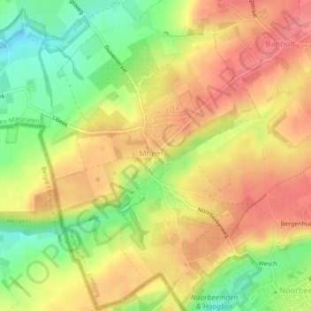
Name: Mheer topographic map, elevation, terrain.
Location: Mheer, Eijsden-Margraten, Limburg, Nederland (50.76717 5.77652 50.79376 5.80787)
Average elevation: 512 ft
Minimum elevation: 364 ft
Maximum elevation: 620 ft
Other topographic maps
Click on a map to view its topography, its elevation and its terrain.
Noorbeek
Nederland > Limburg > Eijsden-Margraten > Noorbeek
Noorbeek, Eijsden-Margraten, Limburg, Nederland
Average elevation: 564 ft